High Resolution Imagery
Unlock the Power of High-resolution Imagery for Every Stage of Your Build
Latest Imagery That Works for You

Ultra High‑resolution Imagery
250% higher than Google Earth, which powers sales and design teams see site details clearly, improving decisions and reducing surprises on the block.

Confidence of Up‑to‑date Data
Frequent date-stamped data updates that allows sales team to see the recent site conditions and developments.

Stronger, Faster Sales Interactions
Instant access to any registered or unregistered address across ANZ.
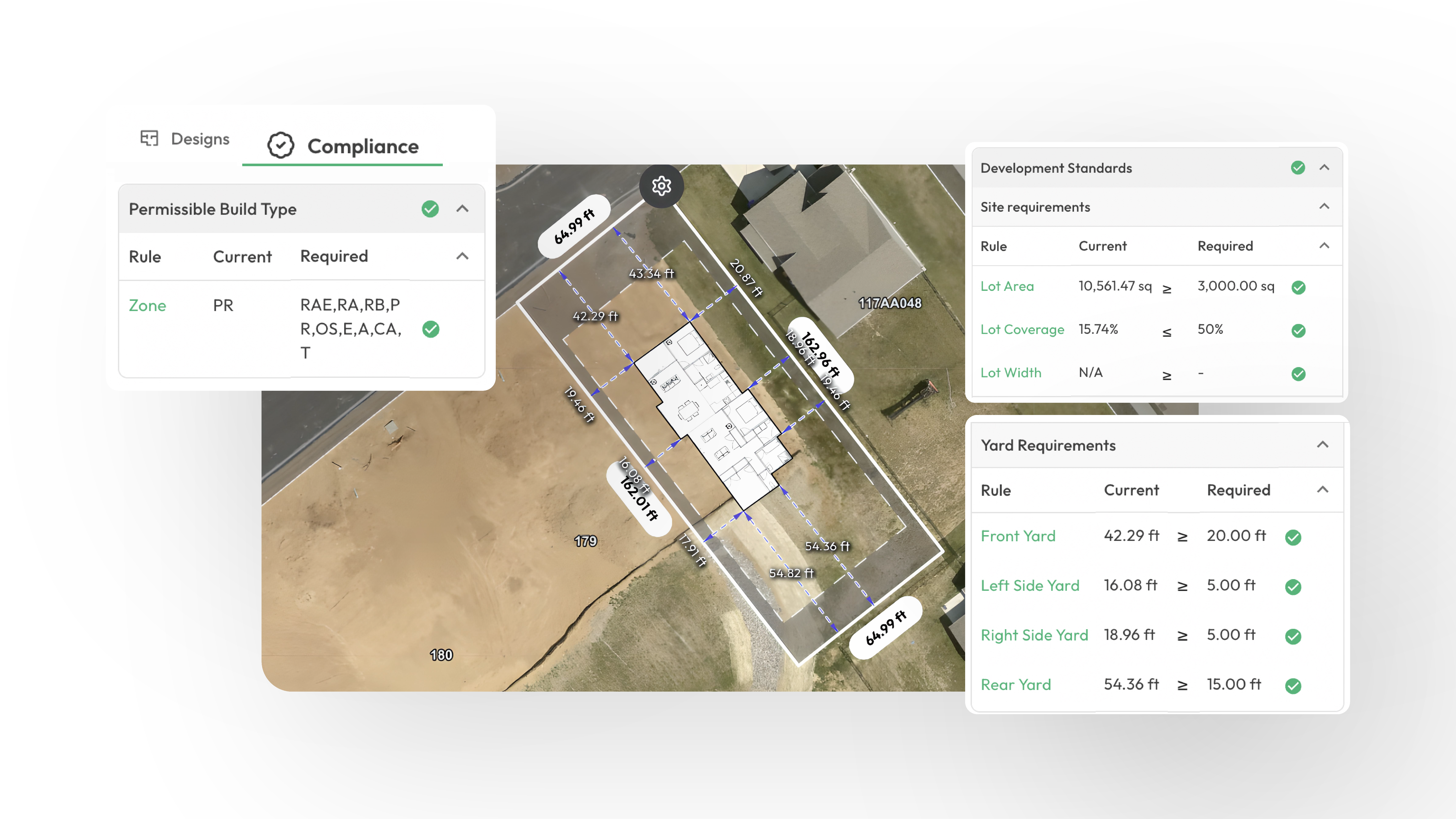
See Your Project from Every Angle

?auto=format&fit=max&w=3840)
Aerial View
Get a clear, detailed overhead view of any property. Perfect for initial site assessments and understanding the full context of the lot.